In March we traveled to Buea for the
wedding of a friend/colleague's daughter. Despite it being just a
couple of hours from Douala, cooler due to its elevation, and it
possessing a number of historical buildings and sites, we had not yet
made it to Cameroon's former capital (under the Germans). So we went
for the wedding then I took a couple of days off work to climb Mt.
Cameroon, west-central Africa's highest peak.
 |
| 50th Anniversary Monument, Buea. |
The principal site of interest is a
monument at the top of town commemorating the 50th
anniversary of Cameroon's independence and reunification. We were
sure that the former colonial governor's residence, built in the
style of a German castle and described in our three guidebooks as the
Von Puttkamer castle/schloss, would be the key landmark. Yet Buea
residents were mystified by references to Von Puttkamer, the schloss,
and the old/German governor's residence. We eventually found it, and
learned that it's not called “the prime minister's residence.”
 |
| The Prime Minister's residence, Buea. |
Admission to the
independence/reunification monument was quite reasonable – 200 CFA
for entry, 500 CFA to take photos (although many Cameroonians present
took more photos and selfies with our infant son than of the lesser
landmarks). We wandered around the small park and took photos of the
buildings bookending the monument – the schloss on one side, and
Cameroon's first post office and a fountain commemorating Otto Von
Bismarck on the other.
 |
| One of apparently many monuments created around the world shortly after Bismarck died, the Bismarck Fountain was built in 1899. |

One puzzling note about the post office
is that while it was founded by the Germans but was “taken over by
the British in 1956”...? (Cameroon was split between the French and
British after World War I.)
 |
| Old post office equipment. |
The day after the wedding, I met up
with my guide and porter to begin climbing Mt. Cameroon.
Incidentally, the trailhead and Mt. Cameroon National Park's office
are next door to the post office.

Thompson, of Ecotour Mt. Cameroon, told
me quite a lot about the plant life as we passed through the farming
zone and the buffer zone before reaching the boundary of the national
park. As a sideline, Thompson also runs an organization, Global Hand Cameroon aimed at promoting conservation on the part of people in the Mt.
Cameroon region.
 |
| Buffer zone forest between Upper Farms area and Mt. Cameroon National Park. |

Thompson noted that some trees are
overused for firewood, when they could regrow if people only took
branches. He said that Bakwerians (the Bakweri people are the
original residents of Buea and the Mt. Cameroon area) are better at
conserving natural resources as they know the plants, while newer
arrivals (drawn to the region by its fertile land) may not understand
as well.


Another plant he pointed out was Fako
grass, which I remembered from a staff meeting when a colleague and
Buea native jokingly suggested we use it to save money on medical
supplies (it can be used as a coagulant). Fako is the local name for
Mt. Cameroon.
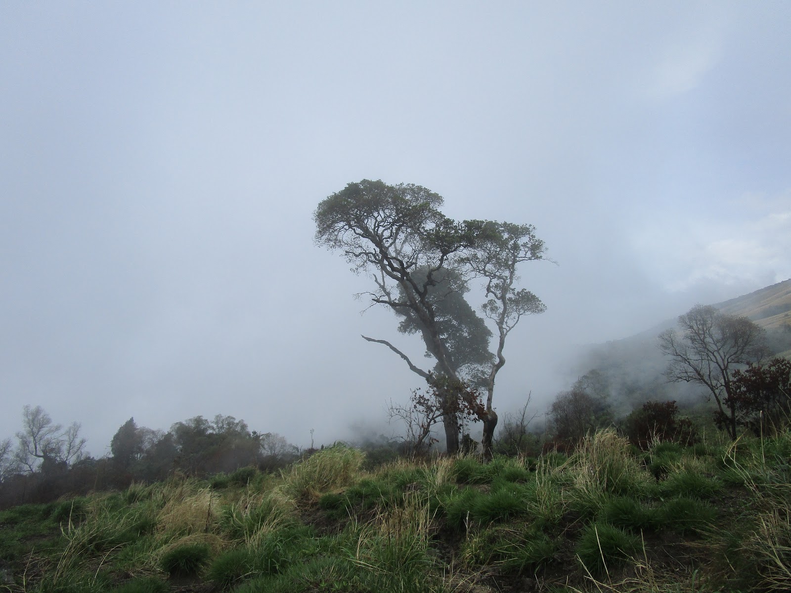
 |
| Mist/clouds making their way up Mt. Cameroon. |

Cocoyams are the main crop around Mt.
Cameroon, and people come from far afield to buy yams (including from
Gabon and Nigeria). Thompson worked as a porter starting in 2007 and
has been a guide since 2011.
 |
| View of Buea from Hut 2. |
Thompson also has started dabbling in
beekeeping, and our porter asked him all about it and it was
interesting to listen along to the conversation, with my limited
understanding of pidgin English aided by some (basic) background
knowledge on bees.
 |
| Bar/restaurant; bathing spot (Hut 2, Mt. Cameroon). |

Our porter recently graduated from a
high school in Buea, and has remained in town doing odd jobs. He's
from Bangem (on the Southwest side of Mt. Manengouba).
Bangem's a smaller town and there've been clashes with gendarmes
(over the “anglophone crisis”) so he's based in Buea despite not
having any family there. He asked me if there was any “benefit”
to going up to the summit to Mt. Cameroon, i.e. What is the point? He
had previously earned money carrying construction sand up to Hut 2,
the base camp where hikers can spend the night, at a rate of 10,000
CFA (approximately U.S.$20) for two bags totaling 17 kgs (40 lbs.).
He had joined a few other hikes, but hadn't gone to the summit
(supplies are left at Hut 2). All told, it took us about 6 hours to
get from the trailhead (at 1,100 metres) to Hut 2 (at 2,800 metres).
 |
| Map showing our path from Buea to the summit. Hut 2 is also known as Fako Mountain Lodge. |
There are several
people working at Hut 2. They stay up there for shifts of 2-3 weeks
before going back down to Buea for leave. There are several new
cabins for tourists and guides, as well as a few camping platforms
for tents. I'm glad I didn't elect to take a tent up as it was very
cold and even the cabins were chilly at night. There is now a graded
access road to Hut 2, so food, drink and building materials are no
longer brought up by hand.
 |
| Hut 2. Limbe is obscured by the clouds to the left. |
From Hut 2 we had
some nice views down to Limbe and Buea, and at night you could see
the lights in Douala. Thompson explained that September is one of the
most popular times of year to climb Mt. Cameroon – even though it
is deep in the rainy season, you can see quite far when the rains
clear (e.g. to Bioko Island, Equatorial Guinea).
An active volcano (its last eruption was in 2000), Mt. Cameroon is part of a (mostly extinct) volcanic mountain range encompassing Sao Tome & Principe, Bioko Island, Mt. Manengouba, and Mt. Oku, among other peaks.
 |
| Volcanic sand on the path up to the summit. |
The next day we
continued up to the summit (at 4,095 m). This was a decidedly less
talkative trip, probably on account of my fatigue and consequent slow
pace. Conditions were cold and windy throughout, with a bit of
drizzle being blown about. As the summit was quite exposed
(everyone's hands were freezing) yet had no visibility, we began our
descent after a few photos.
 |
| The summit of Mt. Cameroon! |

Thompson
explained that business has declined a lot since the start of the
anglophone crisis nearly two years ago. (In short: many teachers and
lawyers in the anglophone Northwest and Southwest regions went on
strike protesting marginalization by the central government, leading
to a prolonged stalemate and some clashes between civilians and the
police and army.) While Buea and Mt. Cameroon are perfectly safe,
blanket warnings from western governments against travelling to
Northwest and Southwest Cameroon meant that I encountered six other
tourists (two individuals, one group) during my three days and two
nights in Mt. Cameroon National Park.
 |
| Descending from Hut 2 to Buea. |

After a second
night in Hut 2, we went back down to Buea. This may have been the
most difficult part of the trip, as the largely direct route up and
especially down Mt. Cameroon was quite hard on the knees. A few slips
notwithstanding, the descent was uneventful. From the trailhead I
caught a taxi back down the hill and then found a quick clando
(private car working as a taxi) to Douala.
 |
| Tasty berries in Upper Farm. |
 |
| View of Mt. Cameroon from our apartment in Douala. |


